
At ETM, innovation is more than a talking point, it’s a commitment to delivering faster, smarter, and more reliable solutions for the communities and clients we serve. That philosophy is at the core of our survey and geospatial practice, which has supported Florida’s growth for more than 100 years through ETM Surveying & Mapping, Inc.
We’re proud to share that our work, and the leadership of our Vice President and Chief Surveyor, Scott A. Graham, PSM, has been featured in a new NavVis case study profiling how wearable mobile mapping is transforming field operations on some of the Southeast’s most complex projects.
How Wearable Mobile Mapping Is Transforming Large-Scale Surveying
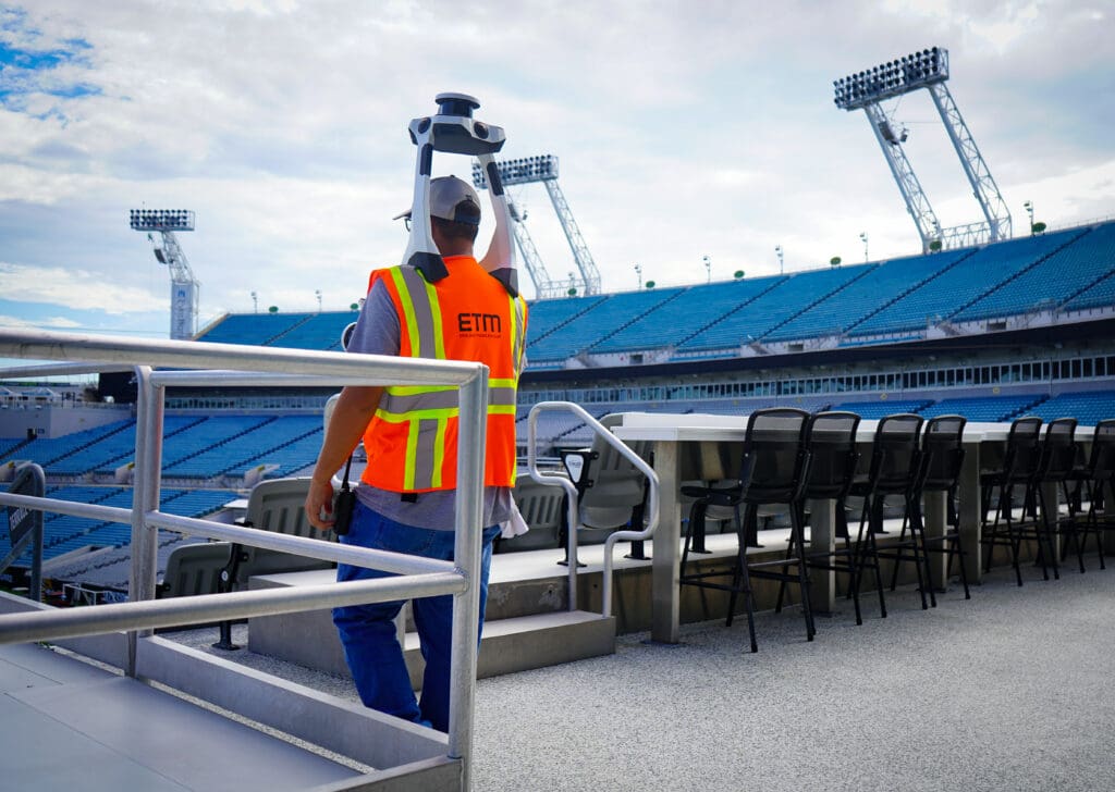
Our introduction of the NavVis VLX 3 wearable mobile mapping system marked a major shift in how we capture data across large, fast-moving project sites. This technology allows our survey teams to move with greater mobility, capture high-density LiDAR, and deliver survey-grade accuracy without compromising speed.
The first major test? A high-profile portion of the Jacksonville stadium renovation program, a site spanning hundreds of thousands of square feet and requiring detailed documentation under tight timelines.
The outcome was unmistakable:
- Survey duration reduced by more than two-thirds: from 60 days to 25 days
- More than $150,000 saved in direct crew costs on that project alone
- Dramatically accelerated modeling and coordination with downstream engineering teams
- A safer, more efficient field workflow by reducing time spent navigating challenging site conditions
These results underscore what tech-forward surveying can achieve: speed, cost efficiency, and confidence in the data.
Applying Mobile Mapping Across Multifamily, Industrial, and Greenfield Sites
Whether we’re supporting complex sports and entertainment venues, multifamily projects, industrial campuses, or 500-acre greenfield master-planned communities, ETM’s investment in innovation ensures our clients receive reliable data, quickly and at scale.
Our survey and geospatial capabilities are an essential part of ETM’s integrated service model, supporting decision-making from due diligence through design, construction, and long-term asset management. As Florida communities continue to grow, tools like NavVis enable our teams to maintain the precision and responsiveness that developers, municipalities, and public agencies rely on.
Explore the Full Case Study
For a deeper look at the Jacksonville stadium project, our field methodology, and the measurable impact of NavVis technology, read the full case study here: