
Article by: Carter Mudgett | Jacksonville Business Journal | Click here to read the full article.
Long before shovels hit dirt on a new building or construction gets its legs, planning must first begin with a survey — the process of creating a geospatial measurement of land.
It’s a pivotal building block for any development project, said Shawn Barnett, executive vice president of survey and geospatial technologies at ETM Survey.
“The thing about survey is that it's one of those disciplines nobody knows about until it's wrong,” he said. “It's a foundational component of everything that is built. Nothing else happens until the survey is done.”
Founded in 1924, ETM Survey is an affiliate of Jacksonville-based England-Thims & Miller Inc.
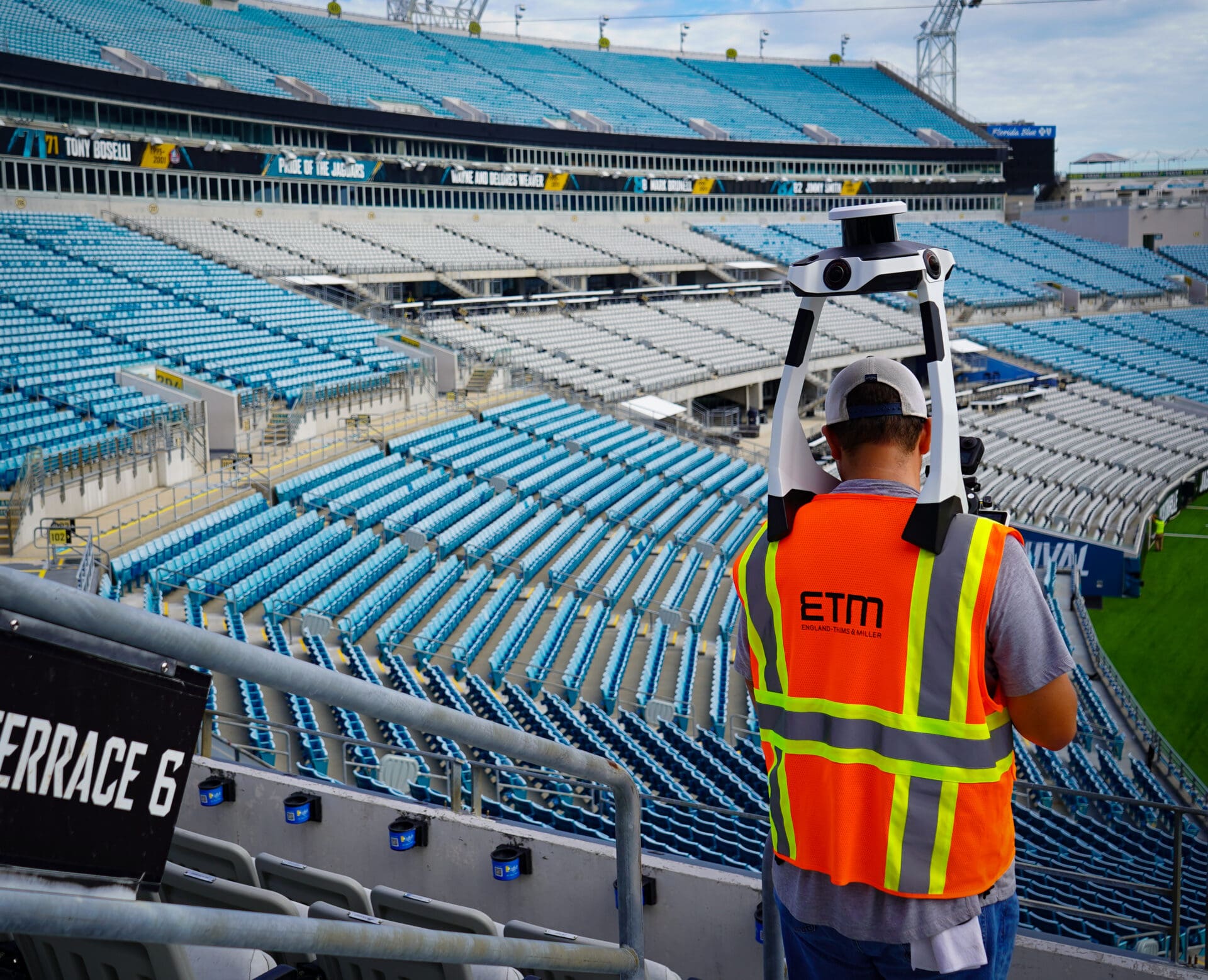
Technological advancements have enabled ETM Survey to chart various projects through the years, most recently surveying the Jacksonville Jaguars’s Stadium of the Future. A century ago, ETM Survey used chains to map out a landscape. Today, it uses LIDAR.
Accurate to the millimeter, LIDAR also supplies engineers with more measurement data to make three dimensional calculations and develop a to-scale, real-world virtual environment.
“Basically LIDAR is a laser that goes out and when that laser hits a point, it creates a measurement,” said Barnett. “Imagine doing that in a 360 degree radius and being able to capture hundreds of measurements per square foot. It allows for a 3D rather than a 2D image data capture.”
There are four ways ETM Survey uses this technology: terrestrial, mobile, aerial and wearable, the latter three of which were used to map out the Jaguars’ stadium.
Continue the Article Here.