Article by: Shawn Barnett, ETM Executive Vice President, Survey and Geospatial Technologies
Municipalities, government agencies, and private investors are constantly seeking innovative solutions to streamline operations, improve decision-making, and enhance overall efficiency. One such cutting-edge technology that has gained significant traction is the concept of the Digital Twin.
What is Digital Twin?
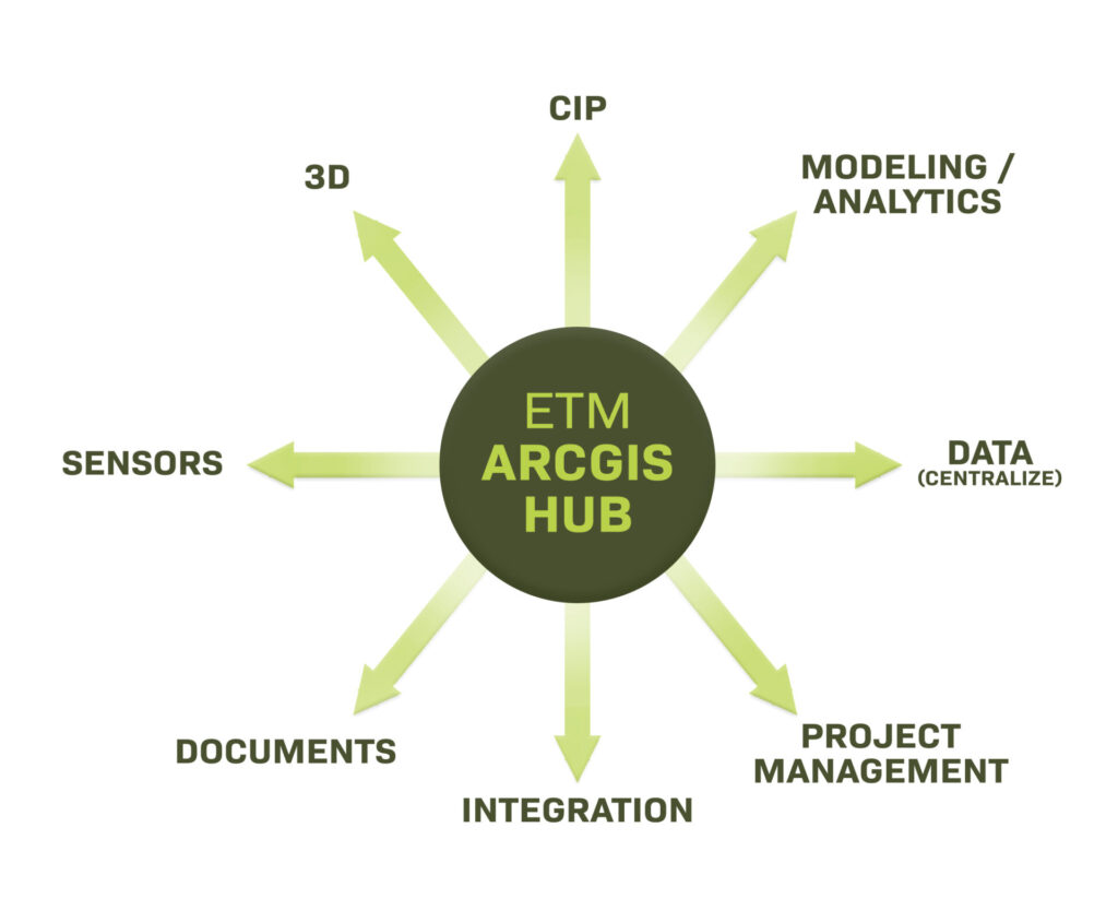
Contrary to common belief, a Digital Twin encompasses more than just a 3D model of a particular area or project. While 3D imagery does play a role in Digital Twin technology, it is just one component among many others. A Digital Twin comprises a diverse range of elements, as highlighted below.
“A digital twin is a virtual representation of the real world, including physical objects, processes, relationships, and behaviors.” – Esri

The elements that make up a Digital Twin collectively provide a virtual representation of a city, municipality, or project that consolidates vast amounts of data into a centralized hub. This hub provides a comprehensive view and decision-making capabilities without you having to gain access to other applications. By efficiently accessing this digital information, stakeholders can run hypothetical scenarios, simulate outcomes, and gain valuable insights to optimize their operations effectively.
How Does Digital Twin Work?
Digital Twin technology operates on the principle of integrating a variety of data sources and systems into one unified digital platform. While there are various Digital Twin theories and concepts, ETM utilizes Esri as a digital hub that serves as the foundation for an efficient Digital Twin ecosystem. The integration of Esri’s ArcGIS platform allows for seamless tapping into existing systems, including Enterprise Resource Planning (ERP) and accounting platforms. This approach enables individuals, such as city leaders, public works professionals, and client liaisons, to seamlessly access vital information.
Why Utilize Digital Twin?
There are many benefits to a Digital Twin, but one of the most impactful may be its ability to consolidate data and make it accessible and usable through just a few keystrokes. This enables users to quickly locate information that was previously difficult to find, such as aging data stored away in a file cabinet or in the mind of senior leadership.
Additionally, the transformation of stagnant data into dynamic, live information enhances decision-making, optimizes processes, and improves overall efficiency.
Shaping a Sustainable, Efficient, and Connected Future
The concept of Digital Twin technology holds tremendous potential for unlocking efficiency and empowering organizations, particularly in the realm of municipal operations, public works, and urban planning. By consolidating large amounts of data into a centralized hub and providing a comprehensive virtual representation, Digital Twins offers stakeholders the ability to simulate scenarios, make better decisions, and optimize operations.
With the integration of advanced technologies such as Artificial Intelligence (AI), Internet of Things (IoT), and data analytics, the future of Digital Twins is even more promising. As this innovative technology continues to evolve and expand, it has the capacity to shape a sustainable, efficient, and connected future by driving innovation, improving decision-making, and maximizing productivity.
About the Author, Shawn Barnett, Executive Vice President, Survey and Geospatial Technologies

Shawn Barnett is an Executive Vice President at ETM and manages ETM’s Geospatial Technologies, Surveying, Aerial (UAS) Solutions, and Subsurface Utility Engineering teams, which support our clients by providing accurate and authoritative data and dynamic mapping and visualizations to improve decision-making capabilities.
Shawn has a background in industrial engineering, business consulting, and various executive positions, which has given him the unique skillset to lead a company in developing sustainable growth and market leadership.
About ETM
ETM, founded in 1977, is Florida’s leading infrastructure and development consulting firm. Their services include planning, development consulting, geospatial technologies, traffic and transportation engineering, water and utilities, construction management and surveying. Focused on serving as “Trusted Advisors, Creating Community,” they provide solutions to public and private sector clients throughout Florida. For more information, visit www.etminc.com
